Saturday 16 January 2016

Glen Nevis Walk

As 2016 arrived, I enjoyed the first walk of the New Year in Fort William. It is an easy walk along River Nevis with impressive vistas- high peaks loom over walkers here. Starting from a small car park at the end of tarmac road in Glen Nevis , I followed a nice, at places rugged path through woodland.


                                       Looking back from the trail , the ridge of Ben Nevis

  Getting to the highest point of my walk so far , the path I walked on approaches the stream of River Nevis , which breaks through the builders on its way. Mesmerizing scenery .

Water of Nevis and An Steall waterfall


Soon, following the stream, I got through an opening in the gorge to the upper section of Glen Nevis, with river running wide. A big waterfall across the Water of Nevis, was the one I had seen once  when standing on the top of Ben Nevis. I have wanted to see this waterfall closely ever since . And here we are , I got there .


The "bridge"


If one wants to cross the stream to get close to waterfall , the simple bridge is at hand. It gives you some thrill when crossing -one false move and you can easly slip down to the water. Fortunatelly, I had gloves, otherwise it would be extremely painfull to keep hands on wet , cold iron rails . And I made it to the other bank without wetting myself .


Steall Hut by the path to waterfall
Boggy path leads to the foot of An Steall waterfall. One of the biggest I have seen in Scotland so far - standing there man can appreciate the power of nature - terrible noise and small particals of water travelling in the air.


I retraced my steps , along the River Nevis , downstream. The weather deteriorated, it got much gloomier , cloudier and drizzle increased. But such a humid conditions help the undergrowth flourish , even in the middle of the winter. That made the walk through this great Glen more pleasant, despite unfavourable weather.


I returned to the car park before the rain started falling for good. Glen Nevis walk is perfect if you don't have much time and there is much to enjoy .


Wednesday 30 December 2015

LEWIS and HARRIS - part III


                                                                           NORTH  HARRIS


Having spent two days in Lewis, I finished my Hebridean Oddysey by exploring a mountainous area of North Harris. The weather was still favourable ; warm and sunny, nearly windless what is not often in these parts. At the midday I arrived from Lewis at the foot of Clisham, the highest hill of Outer Hebrides (799). It had planned to climb its summit from the beginning, so not waiting for a better occasion I jumped  onto the footpath. And it was worth getting on to the top, despite the fact the weather condition had deteriorated slightly up there. The sun disapeared somehow, but at least it didn't rain . The wievs were spectacular .


                                                                    Views from Clisham

Tired after hiking, I rushed to Reinigeadal, a small vilage to the west of A859 connecting Tarbert and Stornoway. This is a cluster of cottages shattered by  sea shore. Following a winding road I got there late afternoon and checked in a small hostel.Thanks to long hours of daylight (in July) I had a plenty of time to cook a hot meal in a hostel  and to go for a stroll  around a small cove nearby, before the darkness fell. It was really like being in the place at the end of the world. Looking west over the Sea I recognized a distinctive Skye's coastline - so far and so close from there.

 Sunset over Reinigeadal

                                                           Scenery along the road to Huisinish 


I left lovely Reinigeadal next morning and Headed to North Harris Eagle Observatory; on tuesdays mornings the North Harris Ranger is on hand to locate Golden Eagles on the skyline. There is about 20 pairs of these magnificent birds breeding on Harris. The observatory is located in Glen Meavig , in the mountains seven miles to the North-West of Tarbert. I had a luck that day to watch the resident pair of golden eagles, flying high over the mountain range. Glad to spot them, I drove on further west, to Huisinish .                                          


                                                                 The Huisinish beach


I had been told that Huisnish and surroundings would be great place for walk, and indeed the place turned out to be splendid, with one of the greatest beaches I have ever seen.The beach has a perfect, smooth sand and the colours of water change during a day. Few people and warm day - that was all I needed that day in Huisinish .


In Huisinish I took part in a guided walk across local Machairs with the same ranger I met in the Eagle Observatory. Machair is a gaelic name for coastal meadows, which are very fertile due to sand mixed with soil. Many species of plants thrive in that environment and ranger explained much aboutl flora and local agriculture too. The local fauna wasn't invting though; medges were bitting us mercilessly every moment we stopped.


                                                    Scarp, a small isle seen from Huisinish jetty

                                                 Road B887 , wiew toward Loch Leosavay  

  
Having no spare time, I left Huisinish behind , driving to Tarbert. I take my time, as the coastal landscape  was spectacular in the late afternoon sun rays.


                                               The boat was a good pretext to stop and take a picture


On the way from Huisinish to Tarbert, at Amhuinnsuidhe, the road runs through an estate with a castle. Under an archway and through the garden drivers go past the castle - that's  nice surprise.


                         Another surprising view, Cliasmol Primary School , almost in the middle of nowhere

                            The "Huisinish" road nearby the "Eagle Observatory"

                          View on West Loch Tarbert , shortly before twilight .


The Sun was gone , shortly before I reached Tarbert. Tomorrow I will be leaving Tarbert and Western Isles, but the image of sunset over Harris will stay in my memory forever .


Map of  Western  Islands


Tuesday 29 December 2015

LEWIS and HARRIS - part II


                                                                                   LEWIS


On Sunday afternoon I arrived in 
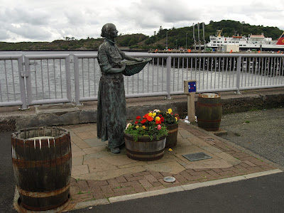
Stornoway , the largest town in all Hebrides and comparing to Tarbert in the south - a metropolis. I found the town very geen , which is surprising as Western Isles are chiefly treeles and the landscape pretty barren. I noticed a number of palm trees too and because there was no wind at all (another surprise), I had impression of arriving to a place somewhere far away from Scotland . There was another surprise awaiting me soon. I had expected that I would be able to buy food and eat something decent in the town . To my amazement the superstore I came across was closed and a petrol station nearby too. I was puzzled when another superstore close to the center was shut as well. I left my car on the seashore promenade and went to find a grocery or a place to eat. Again , neither any grocery nor takeaway was opened , forget a restaurant. Stornoway seemed to be a ghost town ; the streets were lifless, empty .I remembered that on my first visit here a couple years earlier, the town had not been so much deserted .


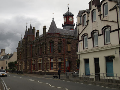
Stornoway town center ( Gaelic: Steornabhagh)


 Soon the mystery was revealed ; Sunday is a holy day, therefore working and running bussiness is forbiden by the local law . The community of Western Isles have been long considered as very pious and devoted to religion . In a hostel where I stayed for the next night, the women who run the place explained the matter . Although the younger generations nowadays have lost the interest in religion, the rule is still valid. It's convienient to have Sundays free of work and relax or visit family, friends . It makes a sense if you think about that for a while .

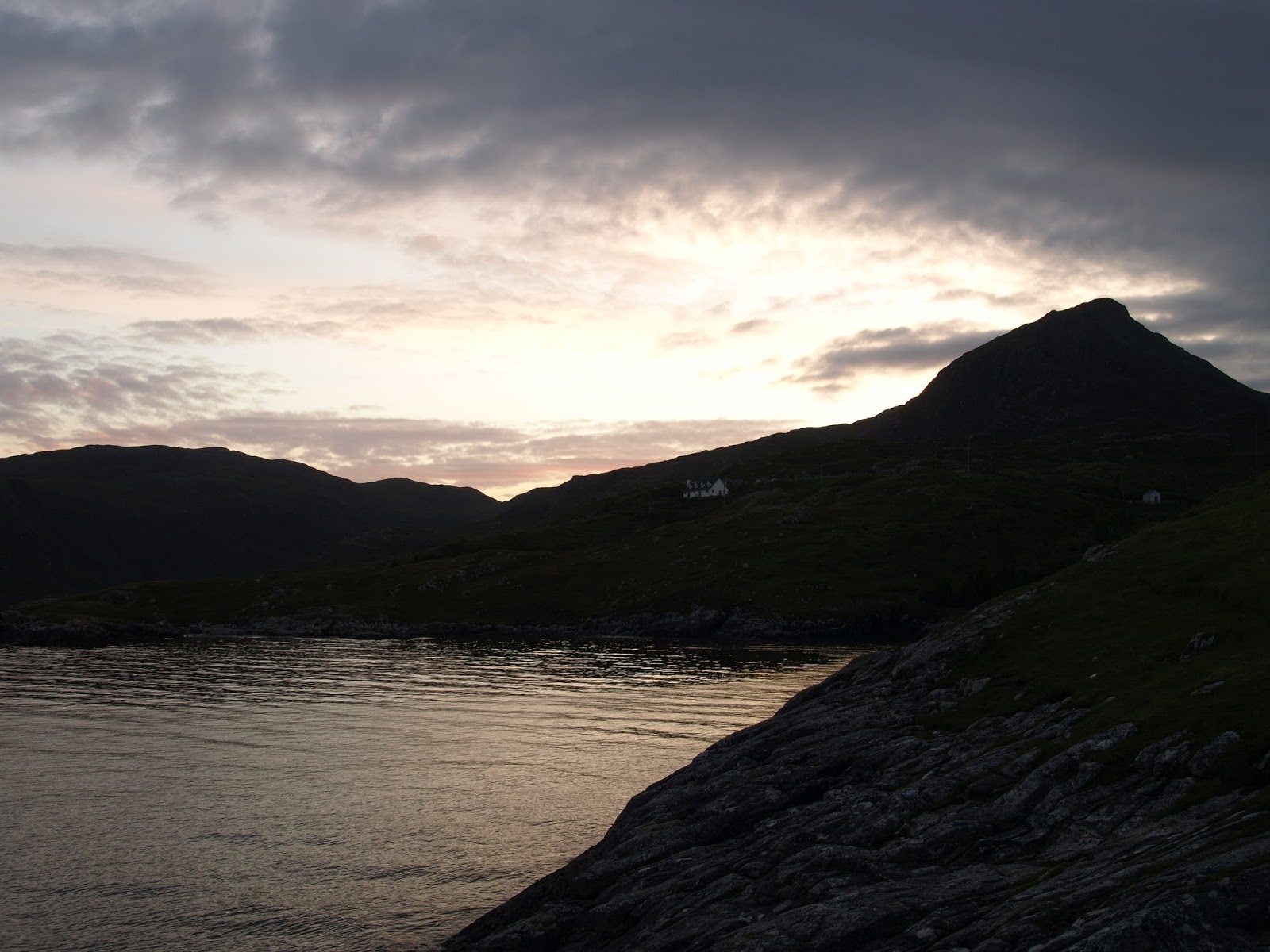
The lash scenery of north tip of Lewis , Ness .

Yet the same afternoon on my arrival to Stornoway , I drove to Port of Ness which is a small settlement in the most northerly tip of Lewis. Most visitors want to see the lighthouse standing on the cliff , at Butt of Lewis (or Rubha Robhanais).


The lighthouse was build in 1862 by David Stevenson , uncle of famous Robert L. Stevenson and constructed using bricks. In 1998 the lighthouse was automated and is being monitored from Edinburgh. In the evening the sunset adds the aura of mistery ; the place at the end of the world. This is one of the most photographed spots in Lewis .


Wiew from Butt of Lewis .


I couldn't omit the small church nearby, in Europaidh.The medieval church of St Moluag was restored in 1912, its form is very simple . Interestingly , over centuries this small temple was famous as a healing place, especially for people with insanity .


                                                                                                     St. Moluag church in Europaidh .


In northern parts of Lewis , there are two dominant elements ; the Sky and grassy , boggy land .There are some villages mainly at the north tip and along the Atlantic shore . Nothing to do nor visit , so by the nightfall I came back to my hostel in Stornoway .


Next day, on morning monday I was busy to visit all important historic monuments on the west side of Lewis.
I started with Black House Museum, so travelled from Stornoway  westward  and then down  along coastal A858. The renovated "Blackhouse" in Arnol is an example how people once lived in Hebrides - the house was inhabited till 1960's. The name derives from black smoke burnt in the fireplace, giving walls dark colours.In the nearby surrondings I could notice a couple remnants of such household in the state of advanced ruin.

Black House, Arnol .


The kirk of Free Church of Scotland , Lewis is it's stronghold in Scotland .


The road signs in Western Isles are usually bilingual, but sometimes I could spot only gaelic place names, like here in Siabost.


Driving down to Carloway, I came across a place which used to be a Vikings' settlement in early middle ages. One of the restored houses was used as a watermill. 
                                                                                                                        
Carloway Broch

No doubt the ancient Broch in Carloway is a must-see monument, one of many historical buildings typical only for north-west Scotland. The round towers, built using only dry-stone method, are found mainly on shores. Constructed about 2000 years ago, their original functions aren't obvious - probably built as watchtowers , possibly these structures were inhabited too. The Carloway Broch is considered as one of the best preserved in Scotland, but I was much more impressed seeing Mousa Broch in Shetlands, which is practically intact. Originally the Brochs were about 10 metres tall, and with spiral staircase leading to the top.


Looking southward from Carloway Broch


                                                            Callanish (Calanais) Stone Ring

Callanish Standing Stones are number one attraction of Lewis, I think most people come to the Island ( which is mostly flat and treeless) to see the famous stones. The stone circle was expanded over centuries ( 3500 - 1500 BC) and there is no clear explanation , what drove neolitic people to erect these stones in a certain order ( the stones form a shape of celtic cross). Given that there are smaller neolitic stone rings nearby, probably Callanish Stones served as ritual place. There is a theory that the circle was erected as an astronomical observatory too, but there is no proof however.


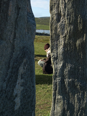
Nevermind scientific theories, the mysterious neolitic stones attract many visitors.The site was already busy when I arrived. One group of women from Norway hired a guide (from a visitor centre at the entry to the site) to hear stories about the Callanish Stones. I noticed a few people trying to meditate somewhere on the outside of the ring. I thought there were perhaps better places for meditation , as there were always people chatting around the stones. I left finally when I saw a large group of people coming in.


Callanish Stones


 After visiting Callanish Stones, I was heading quickly back to Harris , there was nothing else to keep me in Lewis. I pulled off only from the road for a while, just to have a look at  small blocks of peat , dug out and left  to dry out. Dried peat has been long used in Hebrides as a fuel for households and Lewis has a lot of peat.

Eventually, the sight of mountains in North Harris rising on the horizon drew my attention and I moved stright away in that direction , south.


Monday 14 December 2015

LEWIS and HARRIS - part I


                                                                                South  Harris


Isle of Lewis and Harris is the biggest island of Outer Hebrides(or Western Isles) , which is a long chain of isles off north-west coast of Scotland . The larger and mostly flat part is called Lewis , whereas much smaller Harris is mountainous and covers geographicly distinctive, southern area . I went on the tour around this island while visiting nearby Isle of Sky , as an extention of Sky trip . But finally I stayed there longer than I had planned earlier , due to amazing landscapes and smaller number of tourist . On Skye the roads and most popular places were teeming with  sightseekers . On Friday  in the late afternoon , I arrived then at Uig harbour to purches a ferry ticket to Tarbert . To my surprise all tickets for a car passage (next morning crossing ) were sold . The clerk in the ticket office advised me to park my car in the waiting lane overnight . Having left the car in the lane after 11.00 p.m., I went to nearby camping site (I had a tent ). Next morning I was lucky ; I was granted a place on the ferry boat as I was the third in the queue - the other two drivers behind me in the waiting lane wasn't allowed . I could drive in and enjoy the sea crossing on the board .


After an hour and half the ferry got to harbour in Tarbert , which turned out to be a nice, quiet little town. Most visitors started sightseeing with visit at Information Centre just short walk away from the ferry . After getting some fuel I drove south from Tarbert . It was bright, warm day and nearly windlees, but midges were very active and attacked viciously when I pulled off to take a photo .


Harbour in Tarbert (Tairbeart in gaelic)

A couple of miles away from Tarbert I saw something unusual - a large area of sandy beach running wide .


Having driven down close to this magical place I found out it was famous Luskentyre Beach , three miles long stretch of soft , perfect sand . The day was warm and sunny , nearly no wind - I thought it was like a paradise and others  likewise , I think . People were roaming around me , some tried to swim (what a bravery really) others were surfing on the rolling vaves at the furthest end of the beach .


Luskentyre Beach


There were big dunes above the beach and I couldn't help but climb up on top of them . It was a bit like a desert experience on Sahara . And behind dunes by a car park .....

..... the local cemetery .


I left at last lovely Luskentyre Beach and continued driving , heading down along west coast to Leverburgh . On the way the scenery didn't cease to surprise me , like here on the picture to the right .....


                                     .... or here in Northton


                                                    View of Leverburgh ( gaelic An t Ob )


I didn't stop in Leverburgh , where is a ferry connection to South Uist . I was planning to drive back to Tarbert possibly by the end of the evening , following the road along the rugged east coast . But I defenitely wanted to stop for a while in Rodel at the south-east tip of Harris . This little vilage has one of the most important historic buildings on Harris , the late medieval St. Clement's Church .


The church was founded after 1520 by 8th Chief of MacLeod clan , Alasdair MacLeod. His tomb built into the churche's wall ,  is one of the finest medieval examples in Scotland .The picture on right shows a part of epitaph, an Angel glorifying the life of Alaisdar .


Having visited St. Clement's church , I moved north keeping to the east coast of South Harris. I followed  a new road running from Rodel along rocky eastern shores, which is an alternative for drivers travelling to Tarbert . The road winds through rocky, desolate terrain and it has been nicknamed "golden road" , because so costly this enterprise was . There was no land free of "rocky lava" around me and stone-claded hills sprang everywhere - the construction workers building the road must have cursed their job.The movement of cars was minimal and there are only a few tiny settlements along that cost , so probably it wasn't necesarrilly to build the road . But at least the tourists can appreciate this route , as the views were superb ( picture above ). Looking westward I could see the outline of Skye on the horizon , framed by the orange-coloured sky .


I didn't make to Tarbert this evening , decided to stay overnight on camping site near Stockinish . Interestingly , all amenities like bathroom or kitchen were placed inside original "Black Houses" , dry-stone houses which back in time were  inhabited by population of Hebrides .Most of these buildings declined, couple of them have been renovated and serve as tourist attractions. Also the camping area was situated at fabulous spot , in the garden-like stretch of terrain above the sea shore. Only midges were merciless and bit terribly . That's the price for sleeping in a tent , however .


 Next morning (Sunday) I left camping site for Tarbert and  after leaving "Golden Road" I quickly arrived in the main town of Harris. Because of Sunday it was even quieter than on day of my arrival from Skye. I took picture of mini take-away(closed) , ate breakfast at bistro opposit the information centre and moved north , to Lewis. My plan was to get to Stornoway on Lewis.


                                                            View of West Loch Tarbert

Tarbert lies exactly at the point which seperates North and South Harris - narrow isthmus overlooks sea Lochs on both sides , West Loch Tarbert and East Loch Tarbert. From that point, drivers travelling up north face the challenge - driving up through mountains of North Harris , past the highest mountain in Western Isles (Clisham 799m) . The drive is really spectacular , the road winds among peaks and with amazing wievs toward sea on the descent .


Having left the mountains behind me , I pulled over by a memorial  commemorating the landing of Bonnie Prince Charlie on that spot in 1746, when the Jacobite Uprising was over. The Young Pretender was on the run, after his army of Highlanders had been heavily beaten at Culloden.
I went down to the shores of  Loch below (called  Airidh รก Bhruaich in Gaelic) to watch the flight of an Eagle - I spotted probably a Sea Eagle. Unfortunately , my attempts to photograph it failed as the big bird was chased away by seagulls. I came back to memorial and soon after a man came on his bicycle vehicle. I had seen him before - he followed behind me to board the ferry boat in Uig . I vawed to him "hello" but didn't start conversation as the man was deeply contemplating the vistas stretching from the memorial. I left him there and moved on - to discover what Lewis was offering to me . But about that I ll' write in the second part .